Middy hut – Hacket Hut : 18.8km
On est pas encore très au point avec les départs tôt 😆 On prévoyait un départ à 7:00 mais on décolle pas avant 7:30. C’est partiellement parce qu’il fait vraiment bien froid ce matin (sûrement entre 10 et 15C) et qu’on est entouré d’une nuée de sandflies. On prend d’ailleurs notre petit déjeuner dans la tente pour s’en protéger.
Au delà de ça, ce matin, la météo est parfaite avec un ciel complètement bleu. Ça faisait longtemps qu’on l’avait pas vu comme ça. Ça fait plaisir 😊
On découvre que Laura et Fleur sont déjà parties une heure avant nous parce qu’elles sont un peu plus lentes que nous et que la journée va potentiellement être bien longue, dépendamment de notre état à la mi journée 😅. Roxann part aussi 15 minutes avant nous et nous on commence à marcher avec Josh.
Le chemin d’aujourd’hui passe tout d’abord par un joli pont suspendu au dessus de la magnifique rivière turquoise. Après quoi, c’est le début de la souffrance car ça monte sec sur les 4.5km suivants avec à peu près 650m de dénivelé sans arrêt jusqu’à une hut plus haut !
Au début, l’air reste bien frais et nous permet de bien avancer. Mais plus le soleil s’élève, plus la chaleur monte dans la forêt et on finit par gentiment suer comme des bœufs et ralentir un peu. D’autant plus qu’il n’y a pas beaucoup de vent pour aider…
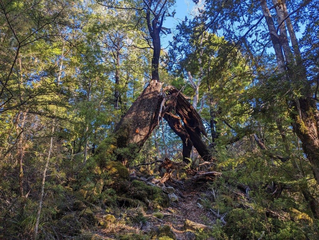
Heureusement, le sentier est vraiment bon pour un chemin de forêt comparé à ce qu’on avait l’habitude d’avoir dans ce type d’environnement.
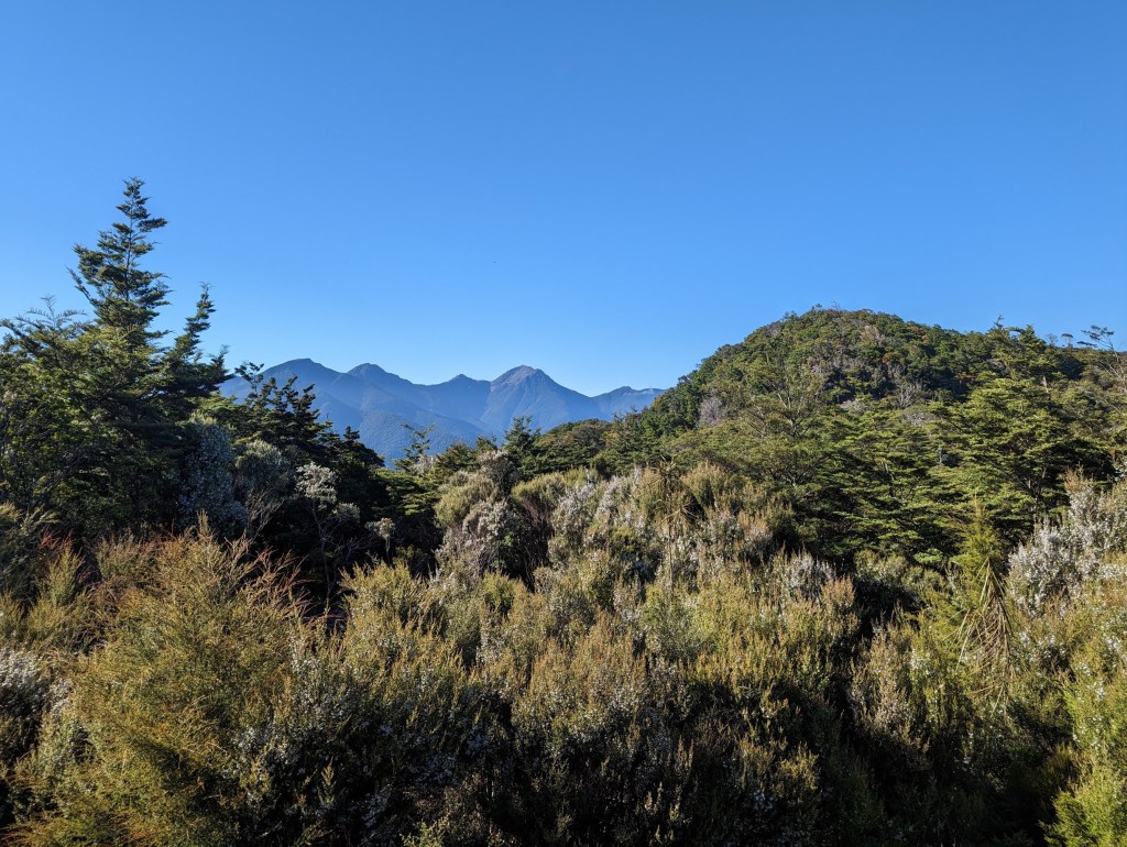
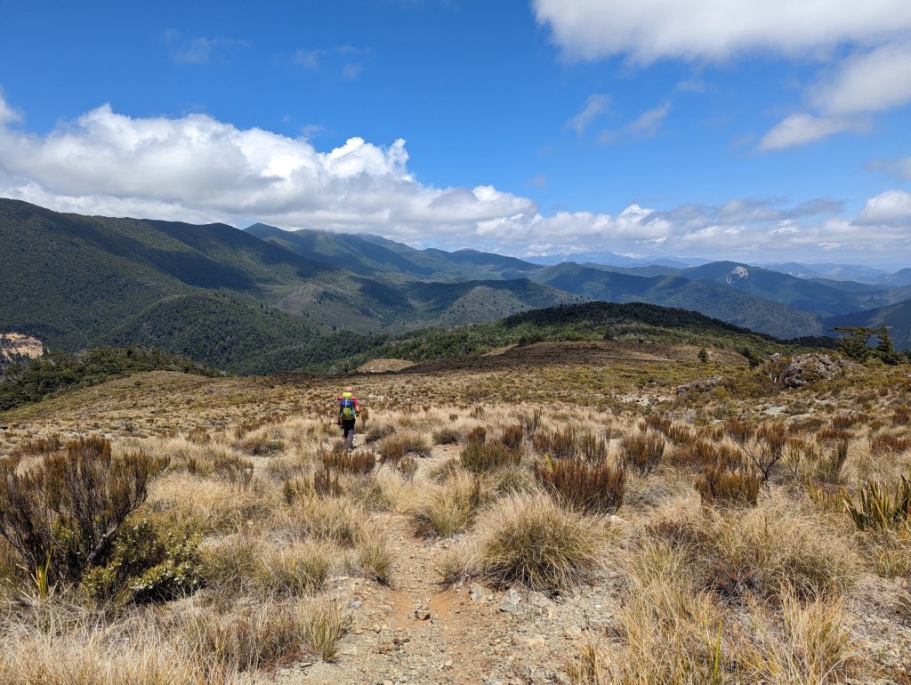
À peu près 2 heures plus tard, on atteint enfin Rocks Hut qui trône fièrement (presque) au sommet de notre première montagne. La vue est magnifique et donne sur ce qu’on pense être le Mt. Richmond. On y fait une bonne petite pause jusqu’à 10:00 avant de continuer.
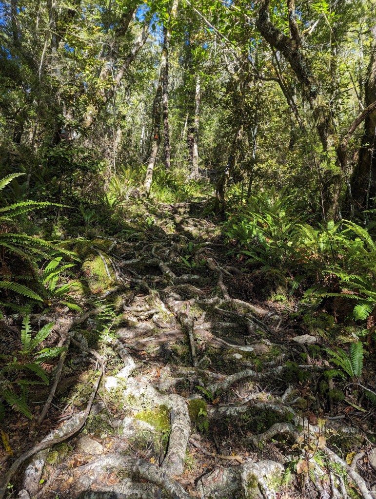
De Rocks Hut à la suivante, Browning Hut, il y a environ 11km à parcourir dans cette même forêt au sol couvert de racines entre lesquelles il faut zigzaguer en faisant attention à ne pas y laisser une cheville, et quand même par endroits la traditionnelle flaque de boue. D’après nos informations, ce tronçon devrait nous prendre 3 heures et on se dit qu’on prendre notre lunch confortablement à la hut.
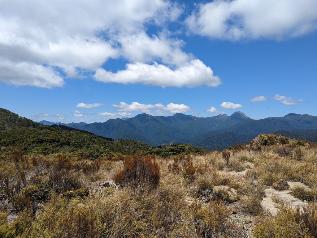
C’était sans compter les quelques centaines de mètres de dénivelé restants (mais beaucoup moins raide) jusqu’à la descente qui déclenchent notre faim. Ainsi, à 12:00 pile, exactement lorsque nous atteignons le point le plus haut de la journée, on change d’avis et on s’arrête net pour déguster notre lunch.
De notre point de vue, on pense apercevoir un des sommets qu’on devrait atteindre demain. Ça semble si loin 😢. C’est aussi à ce moment-là qu’on décide de s’arrêter à notre hut backup plutôt que de s’achever avec 1000m de dénivelé en fin de journée jusqu’à celle initialement visée.
Trois quarts d’heure plus tard, on se lance finalement dans la longue descente jusqu’à notre destination finale du jour : Hacket Hut.
Il nous faudra encore 3 heures pour y arriver mais le chemin continue d’être facile et agréable à suivre. On rattrape d’ailleurs enfin à ce moment-là Laura et Fleur dans la descente ! Il nous en aura fallu du temps haha !
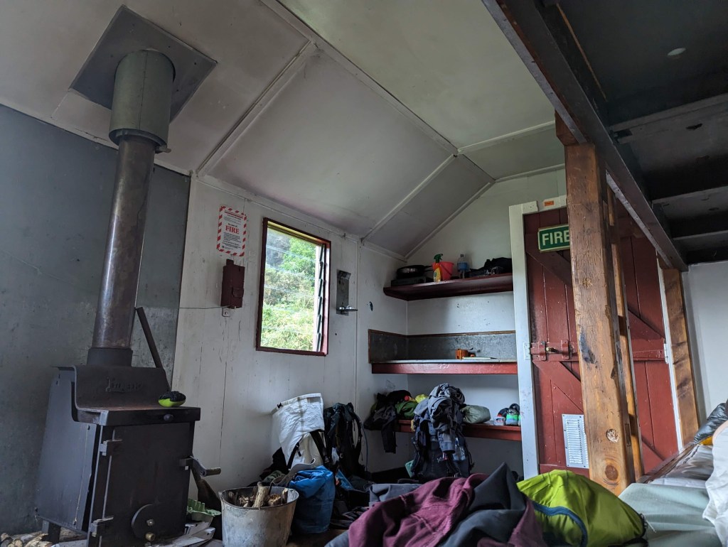
En raison de notre bon rythme de marche, nous sommes les deux premiers à la hut et en profitons pour prendre possession de deux des 6 lits dans cette dernière. Ça nous évitera d’avoir à ranger la tente mouillée de rosée demain matin 😄.
En parlant de tente trempée, on l’a sort pour la sécher et avec le soleil qui tape bien fort, elle sèche en moins de 5 minutes. Magnifique ! Une fois cette affaire réglée, on file vers la rivière pour s’y baigner et s’y laver rapidement. Elle semble moins froide que la veille surtout avec le soleil au dessus de nous. Mais surtout, il y a tellement moins de sandflies qu’aux points d’eau précédents !!!
Entre temps, le reste de notre petite équipe arrive et nous rejoint à la rivière. Ils ont tout juste le bon timing pour occuper les derniers lits car d’autres hikers arrivent… On va être pas mal ce soir, heureusement qu’il y a beaucoup d’espace pour des tentes autour de la cabane. Mais on redoute ce que ça va donner ces prochains jours car il semblerait que tout le monde vise la même hut demain 😬
We’re not quite up to speed yet with early departures 😆 We were planning a departure at 7:00 but we don’t take off before 7:30. It’s partly because it’s really cold this morning (probably between 10 and 15C) and we’re surrounded by a cloud of sandflies. We take our breakfast in the tent to protect ourselves.
Beyond that, this morning, the weather is perfect with a completely blue sky. It’s been a long time since we’ve seen it like this. It’s nice 😊
We discover that Laura and Fleur have already left an hour before us because they are a little slower than us and the day is potentially going to be very long, depending on our condition at midday 😅. Roxann also leaves 15 minutes before us and we start walking with Josh.
Today’s path first passes over a pretty suspension bridge over the beautiful turquoise river. After that, it’s the beginning of the suffering because it climbs steeply over the next 4.5km with about 650m of non-stop elevation gain until the next hut!
At the beginning, the air remains very cool and allows us to move at a quick pace. But the higher the sun rises, the more the heat rises in the forest as well and we end up sweating like crazy and slowing down a bit. Especially since there is not much wind to help…
Fortunately the trail is really good for a forest path compared to what we used to have in this type of environment.
About 2 hours later, we finally reach Rocks Hut which sits proudly (almost) at the top of our first mountain. The view is magnificent and from there we can see what we believe to be Mt. Richmond. We take a good little break there until 10:00 before continuing.
From Rocks Hut to the next one, Browning Hut, there are about 11km to cover in this same forest with the ground covered with roots between which you have to zigzag, being careful not to leave an ankle there, and with, of course in some places, the traditional puddle mud. According to our information, this section should take us 3 hours and we think that we will take our lunch comfortably at the hut.
It was without counting the few hundred meters of elevation remaining (but much less steep) until the descent which triggers our hunger. Thus, at 12:00 sharp, exactly when we reach the highest point of the day, we change our minds and stop right there to enjoy our lunch.
From our point of view, we think we can see one of the peaks we should reach tomorrow. It seems so far away 😢. It is also at this time that we decide to stop at our backup hut rather than finishing with a 1000m of elevation at the end of the day until the one initially targeted.
Three quarters of an hour later, we finally embark on the long descent to our final destination of the day: Hacket Hut.
It will take us another 3 hours to get there but the path continues to be easy and pleasant to follow. We finally catch up at this point with Laura and Fleur on the descent! It took us a long time haha!
Because of our good pace of walking, we are the first two to the hut and take advantage of it to take possession of two of the 6 beds in the latter. It will save us from having to put away the tent wet with dew tomorrow morning 😄.
Speaking of soaked tent, we take it out to dry and with the sun beating down hard, it dries in less than 5 minutes. Fantastic ! Once this matter is settled, we go to the river to bathe and wash quickly. It seems less cold than the day before, especially with the sun above us. But above all, there are way fewer sandflies than at the previous water points!!!
Meanwhile, the rest of our small team arrives and joins us at the river. They have arrived just in time to occupy the last beds because other hikers are arriving… There’s gonna be quite a few people tonight, luckily there’s plenty of space for tents around the cabin. But we’re dreading the hut situation over the next few days because it looks like everyone is aiming for the same ones 😬